

Expected future changes
The province of BC currently advises cities to plan for:
- Half a metre of sea level rise by 2050
- One meter by 2100
Learn more about expected sea level changes PDF file (92 KB)
Globally, sea levels are rising because of a combination of melting glaciers and thermal expansion of sea water from warmer temperatures.
In Vancouver, 1 meter of sea level rise would result in 13 square kilometres of land being in the floodplain.
Map of sea levels, 2016 and 2100, if no adaptation measures are implemented
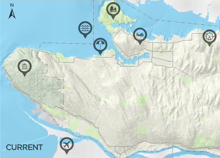
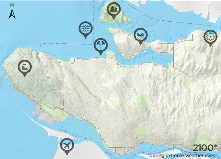
Legend
 Downtown
 English Bay
 Kits Beach
 Airport
 PNE
PNE Stanley Park
 UBC
UBC
Building the future we want
A city that is resilient to sea-level rise means:
- Safer shorelines and continued access to treasured coastal areas
- Planning for the future with a citywide coastal adaptation and flood management policy
- Trying out creative approaches to coastal resilience, such as nature-based solutions
Help us document rising sea levels
Take photos of king tides or coastal flooding in Vancouver. These photos will help us better understand how the shoreline is changing.
Email your photos to [email protected] or post to social and tag us @greenestcity.