
Our cycling map is now offered in multiple formats: a downloadable PDF, an interactive digital web map, and a physical printed map.
Plan your ride with the interactive cycling map
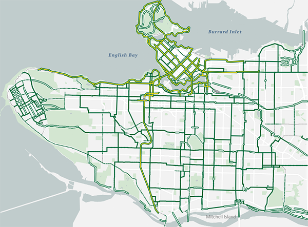
Explore Vancouver’s bikeways, greenways, and leisure routes with our interactive digital map. The more you zoom in, the more route details and features you’ll discover.
Information icon Turn on browser location permissions to use the “Locate Me” feature and find nearby cycling routes. Make sure your device is updated to the latest iOS or Android version for the best performance.
Get a cycling map
The 2026 cycling map is now available. Pick up a printed copy at City Hall, community centres, and libraries.
Download cycling map PDF file (9.7 MB)Order 50 or more printed maps
Explore the best of Vancouver
Visit iconic sights, explore vibrant neighbourhoods, and enjoy Vancouver’s natural beauty by following these featured bike routes.
Information icon Journey times don’t include rest stops. Give yourself up to an hour (on top of the estimated travel time) to fully enjoy the ride. Some routes navigate hills or gravel sections, review the route features and highlights before you ride.
-
-
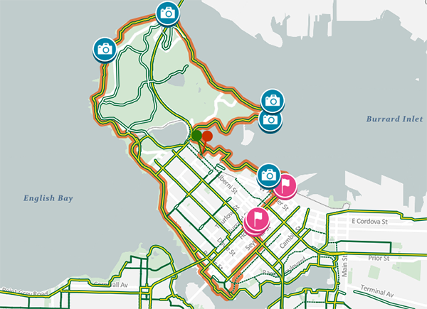
Iconic Vancouver bike route
If you’re short on time or it’s your first visit, this ride takes you to Vancouver’s most iconic sights, including Canada Place, Stanley Park, and the West End.
-
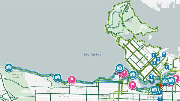
Seaside Vancouver bike route
This route showcases Vancouver's stunning beaches and parks. It begins in False Creek, leads to Spanish Banks beach and viewpoint, and returns along the seawall with spectacular skyline views.
-
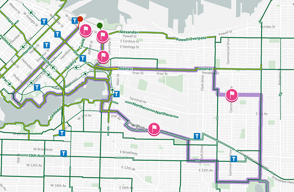
Creative Vancouver bike route
If you want to explore lesser-known areas of Vancouver, this ride takes you through some of the city's vibrant neighbourhoods and dynamic public spaces.
-
Disclaimer of responsibility
Plan your cycling trip
Contact us
Email: [email protected]