

What's happeningProject updates
The Imagine West End Waterfront Vision: Alternative Phase 1 – Report Back (for decision) PDF file (33 MB) was approved by the Park Board on October 7, 2025.
- Review the report and vision PDF file (33 MB)
- Review the April 22, 2024 Park Board meeting
- Review the May 8, 2024 Council meeting
- Review the draft vision in the Round 3 What We Heard Report PDF file (16.1 MB) to learn about community feedback
- Learn more about the project's background and public engagement
We have concluded the planning process for a comprehensive long-term vision and plan for the West End's waterfront parks, beaches, facilities, and the surrounding street network. Thank you to the community members who participated and provided input — we couldn’t have done it without you!
The West End waterfront boasts a continuous seaside greenway, expansive beaches, and views of English Bay, the Salish Sea, and Vancouver Island beyond.
Location
The project area's parks, beaches, and streets are located on the unceded, traditional, and ancestral territories of the xʷməθkʷəy̓əm (Musqueam), Sḵwx̱wú7mesh (Squamish), and səlilwətaɬ (Tsleil-Waututh) Nations and represents a place of great cultural, spiritual, and ecological significance.
Note Private residential buildings are not part of the project scope.
Waterfront parks and streets system
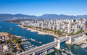
This is a popular and loved public space where residents and visitors come to experience nature and the ocean, enjoy leisure activities and special events, and walk or cycle on the Seaside greenway (Seawall).
The waterfront park system fronts onto the West End community, one of the densest neighbourhoods in all of BC. The area is only expected to intensify with increased population growth and tourism. This increased demand, along with climate change and aging infrastructure, will put pressure on the parks amenities and the seawall.
We aim to provide a compelling and inspiring plan, considering:
- Park identity and functionality
- Neighbourhood connectivity and access
- Seawall experience and comfort enhancements
- Coastal shoreline habitat and restoration
- Climate change and resilience
- Park services, facilities, and infrastructure upgrades
Why we need a plan for this area
A long-term plan will help address the pressures facing the West End waterfront while creating new opportunities to experience and enjoy the area over the next 30 years. Learn more about the challenges and opportunities.
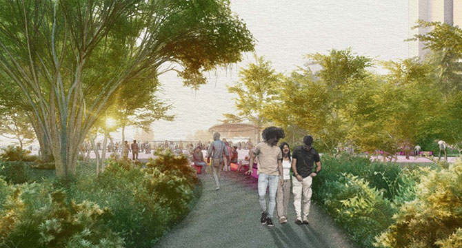
Information icon This image is for illustrative purposes only.
Timeline
-
Jan - Aug 2021
Gather information
Gather information and stories about the neighbourhood’s parks, streets, and spaces to build a shared understanding of the area and guide high-level plans and concept development.
-
Sept - Dec 2021
Listen and learn
Communities share how they use, value, and experience the West End Waterfront and their vision for the future.
-
Winter 2022 - spring 2023
Develop initial concepts and ideas
Develop initial concepts from ideas generated from Phase 1 and 2 that support principles and visions for the West End Waterfront.
-
Fall 2023
Draft concept design
Invite feedback on a refined conceptual design based on community input and technical analyses
-
Spring 2024
Board decision
Presentation of final concept design and Imagine West End Waterfront Plan to elected Park Board and City Council
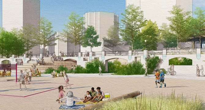
Information icon This image is for illustrative purposes only.
West End Community Plan
The West End Community Plan (approved in 2013) identified potential needs for long-term improvements to the transportation system, parks, and public spaces in the area to support the growth in the West End. The project study area overlaps a network of parks and streets that make up a total of approximately 95 acres (38 hectares).
The key components include:
- English Bay Park
- Sunset Beach Park
- Morton Park
- Alexandra Park
- Roadways of Beach Ave, Pacific Blvd, and the foot of Davie St
These components have been combined into one study area to create a consolidated effort in improving the entire West End waterfront experience for residents and visitors alike.