

The riverfront trails from McCleery to Deering Island are part of a larger network of trails running along the Fraser River from Boundary Road in the east to Musqueam in the west. This route will take you through the only portion of the Agricultural Land Reserve within Vancouver.
Route statistics
| Distance | 1.55 km |
| Steps | 2034 |
| Elevation change | 5 m |
Route description
This quiet agricultural area is ideal for those looking for a slower lifestyle within a major urban city. The equestrian paths, riverfront trails and quiet streets make for an almost zen atmosphere any time of the day.
Accessibility
Equestrian trails, compact gravel paths and city streets make up this route. There are no sidewalks in Southlands, pedestrians must share the roads with horses and vehicles.
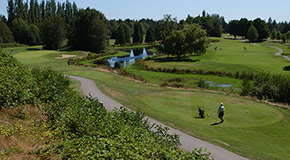 Surrounded by beautiful mature trees, the fairways and greens of McCleery Golf Course offer a challenging game in an inspiring setting. The golf course is located on the banks of the Fraser River adjacent to Vancouver’s only remaining farmland.
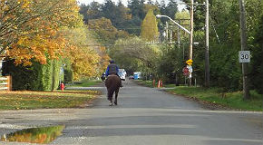 Equestrian and pedestrian trails cover the Southlands area running along the Fraser River from McCleery Golf Course to Musqueam Park.
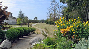 Located on a small island in the Fraser River, Deering Island Park is a semi-natural area perfect for enjoying the peaceful views of the river and tidal marshes. In late summer, the park is filled with dragonflies and the sweet scent (and flavour!) of blackberries. Over time, due to desired shipping access up the river, the flora and fauna have changed from what you might once have seen in this location.