School Travel Planning

What you need to know

Since 2012, we’ve consulted 3 to 6 schools each year to identify transportation-related challenges and opportunities, improve safety, and increase the number of children walking and cycling to school.

To date, 42 schools have participated in School Travel Planning.

Key partners

  • City of Vancouver
  • School staff
  • Parent Advisory Council (PAC)

Additional stakeholders

  • Vancouver Police Department (VPD)
  • Other community organizers and agencies

Through the School Travel Planning program, we work with school communities to support active and sustainable travel to and from school.

We use a comprehensive approach known as the 5Es, which are:

  • Evaluation: Collect information to understand context and monitor changes
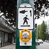
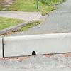
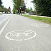
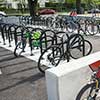
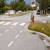
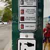
  • Engineering: Improve infrastructure near the school
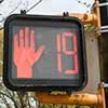
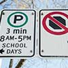
  • Enforcement: Increase compliance with traffic laws and parking regulations
  • Education: Change perceptions of active travel and support programs to improve safety and reduce conflicts between modes
  • Encouragement: Promote active travel as a fun, easy, and exciting way to get to school

Action plans and route maps

Find action plans and best walking and cycling route maps for schools that have participated in the School Active Travel Planning program.

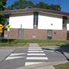
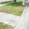
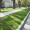
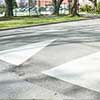
Common infrastructure items to improve school safety

By City of Vancouver

See how we improve school infrastructure and support activities that promote school safety and active travel.

  • New marked and raised crosswalks

    By City of Vancouver

    Crosswalks alert people driving to expect people walking. Raised crosswalks reduce vehicle speed and increases pedestrian visibility. Pictured: Thunderbird Elementary, Cassiar St at Hermon Drive.

  • Curb ramps

    By City of Vancouver

    Curb ramps and bus pads improve accessibility for people using wheelchairs, walkers, and strollers. Pictured: Sir Sandford Fleming Elementary, Lanark St at E 47th Ave.

  • New sidewalks and curbs

    By City of Vancouver

    Sidewalk segments address gaps in the walking network. Sidewalks and curbs provide a continuous walking experience separating people from traffic. Pictured: Lord Kitchener Elementary, Collingwood St between W 24th Ave and W King Edward Ave.

  • Speed humps

    By City of Vancouver

    Speed humps are a traffic calming measure used to reduce vehicle volume and speed on local streets. Pictured: Lord Kitchener Elementary, W 24th Ave between Collingwood St and Blenheim St.

  • Rapid rectangular flashing beacons

    By City of Vancouver

    These high intensity amber flashing beacons are installed at crosswalks and are activated by a pedestrian push-button. The beacons increase pedestrian visibility and alert drivers to yield at marked crosswalks. Pictured: Renfrew Elementary, Cassiar St at E 22nd Ave.

  • Pedestrian/bike activated signals

    By City of Vancouver

    Assists pedestrians and cyclists in crossing major streets by providing signal-protected pedestrian crossing phases.

  • Pedestrian signalized crossing improvement

    By City of Vancouver

    Countdown timers show how much time is left to cross the street at an intersection. This reduces the number of people crossing the intersection when the light changes. Pictured: Lord Kitchener Elementary, Blenheim St at W King Edward Ave.

  • Signage

    By City of Vancouver

    Clarifies pick-up/drop-off operations, indicates various parking regulations, and improves sight-lines.

  • Barriers

    By City of Vancouver

    These low-gravity concrete barriers regulate traffic flow and discourage U-turn activity. Pictured: Eric Hamber Secondary, Willow St at W 35th Ave.

  • Protected bicycle lanes

    By City of Vancouver

    Protected bike lanes are on-street bike facilities physically separated from motor vehicles. These lanes can be elevated or protected from traffic by various treatments such as curbs, parked cars, concrete median and planters, and/or bollards. Pictured: Eric Hamber Secondary, Willow St between W 33rd Ave and W 35th Ave.

  • Bicycle racks

    By City of Vancouver

    Installation of bike racks provide secure bike parking at schools. Pictured: L’Ecole Bilingue, W 14th Ave at Alder St.

  • Bus pads

    By City of Vancouver

    Bus pads improve access for people using wheelchairs, walkers, and strollers at bus stops and waiting areas. Pictured: Carnarvon Community Elementary, W 16th Ave at Balaclava St.

  • Street mural

    By City of Vancouver

    Street murals are a school or community-led initiative, supported by the City, to apply artwork to the street as a traffic-calming measure. Pictured: Kerrisdale Annex Elementary, W 43rd Ave.

  • Student art

    By City of Vancouver

    Signs and artworks created by students raise awareness of travel safety around the school. Pictured: Sir Sandford Fleming Elementary.

  • Curb bulges

    By City of Vancouver

    Curb bulges pull together the two sides of the streets together for pedestrians. They shorten the distance a pedestrian is actually on the asphalt, and increase the visibility of pedestrians waiting to cross by providing them a perch or a pedestal to be prominently seen by oncoming drivers.

  • Pedestrian decals - Safety tips

    By City of Vancouver

    Installed above the pedestrian crossing button, this placard reminds users of the correct crossing etiquette. Remember, pedestrians should only ever enter an intersection when the white crossing silhouette is illuminated.

Promote active travel at your school

Whether you’re a student, teacher or parent - you can take action to promote active travel at your school:

Download the Active School Travel poster:


Related projects

School Active Travel Program

Our program seeks to encourage and promote walking, cycling, and rolling to school.

Transportation 2040 Plan

Our plan provides a vision for how people and goods move in and around Vancouver for the next 30 years.

Climate Emergency Action Plan

Our plan focuses on cutting carbon pollution from our biggest local sources: burning fossil fuels in our buildings and vehicles.